
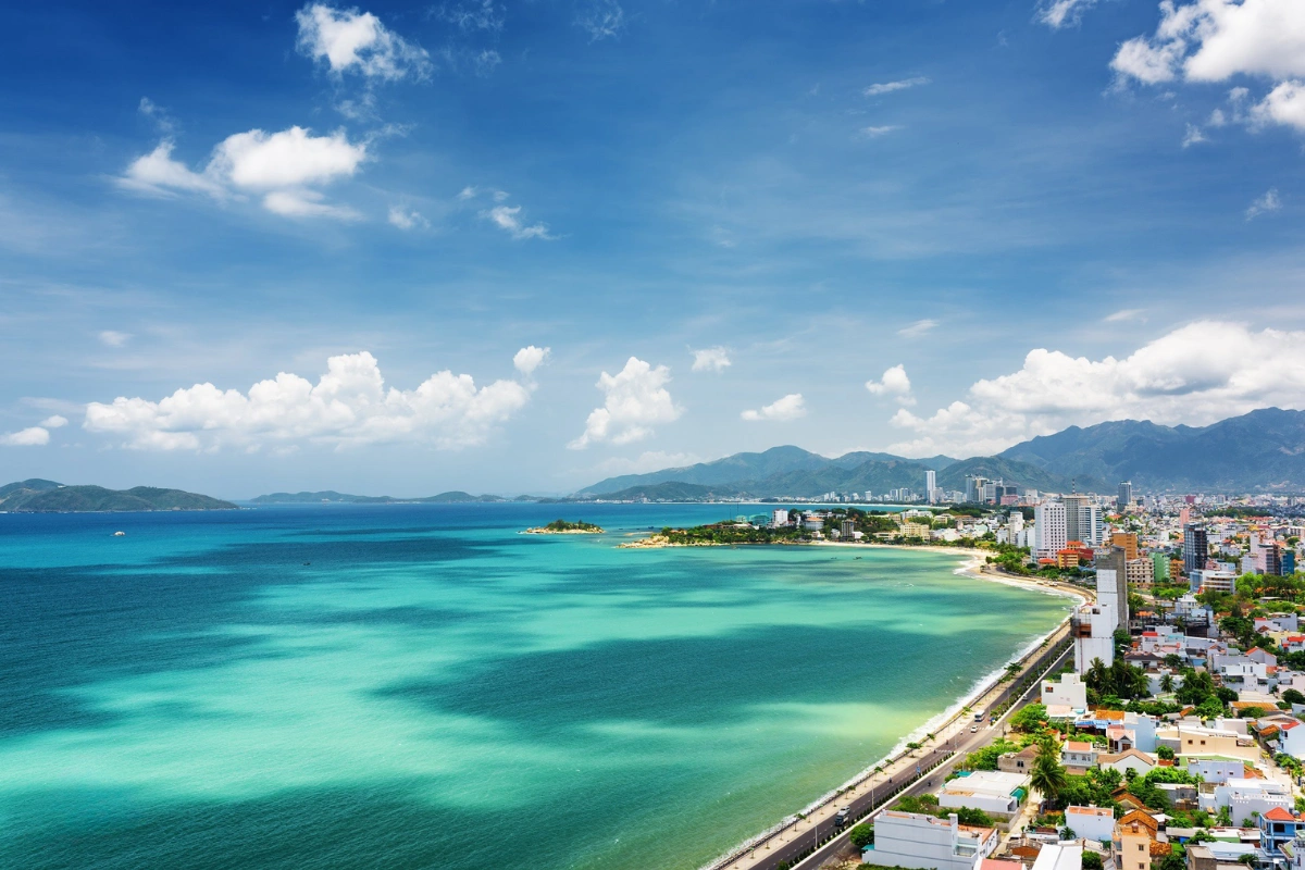


Nha Trang Beach is central Vietnam’s premier coastline, yet glossy photos often hide water quality variations and rip currents. Measuring 7 kilometres along Tran Phu Street, safe swimming depends on choosing mid-beach zones and monitoring seasonal conditions. Here is your verified guide to water clarity, rip current survival, and realistic beach planning.

Nha Trang Beach is the most photographed stretch of coastline in central Vietnam. Most of those photos are honest. But they skip three questions nobody answers upfront: how long the beach actually is, whether the water is clean, and whether it is safe to swim in today. I am Vani, founder of Truly Voyage. This guide is built around exactly those three gaps: verified length, documented 2026 pollution data, an active rip current warning, and the specific changes reshaping this waterfront through 2025 and 2026.
None of this is meant to scare you away from a beach I still recommend.
It is meant to replace guesswork with numbers before you book anything.
Table of Contents
ToggleHow Long Is Nha Trang Beach, Really?
The swimmable stretch runs close to 7 kilometres, not the 12 to 16.4 kilometres you will often see quoted; those bigger figures measure the road system running beside it, not the sand itself.
Ask five different guides how long Nha Trang Beach is and you will get five different answers, most of them wrong in the same direction. Six independent sources, including Vietnam Tourism’s own figure cited on Wikipedia, alongside Vinwonders and Breathe Vietnam, converge on approximately 7 kilometres for the actual swimmable strip (Source: Wikipedia).
That is the beach length in kilometres worth remembering, not the rounder 6 kilometre figure still doing the rounds on older sites. The 12 kilometre number that shows up almost as often actually measures Tran Phu Street itself, running from Cau Da Port in the south to Bai Tien Beach in the north—the road, not the sand beside it (Source: Crystal Bay).
A 2025 provincial redevelopment plan pushes the confusion even further, quoting 16.4 kilometres for the combined Tran Phu–Pham Van Dong corridor, two connected roads measured together for masterplanning purposes, a figure you will meet again further down this page.

Geographically, the beach runs through the middle of what locals still call Nha Trang city, even though the name changed on paper. Vietnam’s July 2025 provincial reorganisation folded Ninh Thuan into an expanded Khanh Hoa province, and Nha Trang itself now carries ward status rather than city status within it, a genuine administrative shift, not just semantics. The beach, the promenade, and every hotel address along Tran Phu Street stayed exactly where they were.
Only the paperwork changed.
Why Locals Call It Tran Phu Beach, Not Just Nha Trang Beach
Nha Trang Beach and Tran Phu Beach are the same stretch of sand, named after the street running alongside it rather than the city itself. Most hotels, taxi drivers, and Vietnamese-language listings default to Tran Phu Beach as the practical name, since Nha Trang is an entire region and Tran Phu Street pins down exactly which beach you mean. International visitors searching for information tend to use the city name instead, since it reads clearer to anyone unfamiliar with the local street grid. Both names point at the identical 7 kilometre stretch, so do not treat a listing under one name as a separate, undiscovered spot from a listing under the other. It is the same beach either way, just described through two naming conventions that both remain in everyday use.
💡 Vani Tip: If a map pin says Tran Phu Beach and another says Nha Trang Beach, do not plan two separate visits around them. You would simply be walking the same 7 kilometre stretch twice under two different labels!
Is Nha Trang Beach Clean?
No, not uniformly, and the honest answer sits between the postcard version and outright avoidance: current, official monitoring data shows real, location-specific pollution alongside stretches that are genuinely fine for a swim.

Pollution here is not a new story invented to alarm you. Back in 2013, researchers already documented five sewers discharging directly into the sea, five more into the Cai River, and roughly 180 riverside households with no toilet connection at all, with coliform contamination even inside the marine protected zone (Source: VietNamNet).
A peer-reviewed 2025 dataset paper tracking 16 monitoring stations across the bay from 2013 to 2024 confirmed organic pollution spiking in two separate windows, with tourist arrivals and aquaculture density identified as the two biggest drivers of nutrient loading (Source: MDPI Journal Data). That is the historical baseline. The current numbers are worse in one specific respect.
What the 2026 Mercury Data Actually Measured
The Nha Trang Bay Management Board’s own 2026 monitoring recorded mercury concentrations 13 times over Vietnam’s national standard at Vinh Luong fishing port, and 6.8 times over standard in North Nha Trang Bay, alongside elevated microbial density at several points (Source: Thanh Niên). A separate March 2026 investigation traced illegal wastewater into an 800mm storm drain serving three streets in Bac Nha Trang ward, discharging dark, foul-smelling water with visible sediment straight onto the sand.
Officials opened administrative violation cases, removed the unauthorised pipes, and funded a 2026 to 2030 infrastructure project to fix the underlying cause rather than just the symptom (Source: Nông Nghiệp Môi Trường). None of these monitoring points are the main swimming stretch along Tran Phu Street itself. They are fishing ports, storm drains, and reef zones nearby, which matters, but does not make the wider bay’s pollution problem someone else’s issue to worry about.
What none of this means is that the swimming beach is closed or unsafe day to day; no source reports the main Tran Phu strip itself as unswimmable. What it does mean is that clean-looking water in a photo is not the same as a clean bill of health for the whole bay, and treating this beach as automatically pristine is where I disagree with most travel guides you will read before visiting.
💡 Vani Tip: If you want the cleanest swim on this stretch, aim for mid-beach sections (between Tue Tinh Street and 2/4 Square) well away from the Vinh Luong port area to the north and the Cai River drainage outlets. Ask your hotel whether there has been any recent discharge notice—most front desks along Tran Phu Street track this closely because guests ask.
Can You Swim at Nha Trang Beach Safely?
Yes, most days, but late May through June and the May to July jellyfish window both carry documented, official hazards worth planning around rather than dismissing as generic caution.
Khanh Hoa Provincial Police issued a dedicated public safety explainer on rip currents in June 2026, describing exactly how to spot one and flagging late May through early June, when student summer holidays overlap with the tourist peak, as the highest-risk period of the year (Source: Công An Tỉnh Khánh Hòa). This was not a theoretical warning. Two documented 2026 incidents preceded it: on February 21, ten swimmers were swept out by large waves and rescued, though one foreign male tourist died, confirmed directly by the Nha Trang Bay Management Board’s director (Source: vietnam.vn). On March 18, another tourist was swept out and rescued, with officials attributing the risk to unusually large 2 to 3 metre waves in stretches known for dangerous currents (Source: DTiNews).
How to Recognise and Escape a Rip Current
A rip current is a narrow, fast-moving channel of water pulling directly away from shore, and Khanh Hoa police’s own guidance breaks recognition and response down into steps simple enough to remember under stress:
- 👁️ Step 1: Scan the surface — Look for a visibly darker or calmer-looking patch of water flanked by breaking waves.
- 🌊 Step 2: Check the debris line — Watch for foam, seaweed, or suspended sand moving steadily seaward rather than rolling in with the surf.
- 🛑 Step 3: Never swim directly against the flow — If you get caught, do not paddle straight back to shore; you will exhaust yourself fighting a current stronger than any Olympic swimmer.
- 🏊 Step 4: Swim parallel to the sand — Paddle sideways, across the current toward the breaking waves, until you feel the seaward pull release.
- 🙋 Step 5: Conserve energy and signal — If you cannot break free, roll onto your back, float to preserve oxygen, raise one arm, and call for lifeguard assistance.
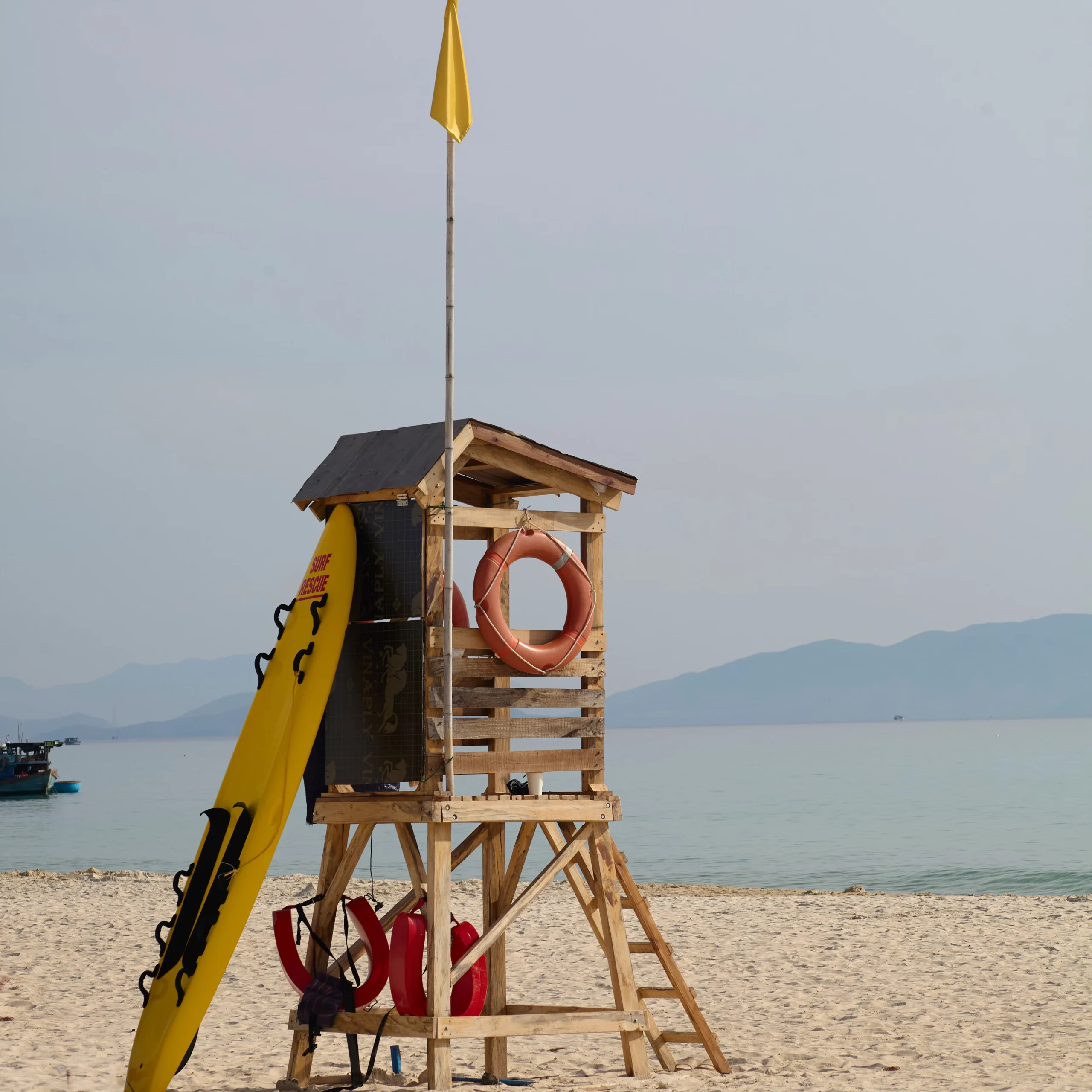
Fire Jellyfish Season Runs May to July
Fire jellyfish, a Portuguese man o’ war type species known locally as sứa lửa, appear predictably every year between May and July, and both 2024 and 2025 saw official public warnings issued once sightings began. The 2024 warning came from the Nha Trang Bay Management Board itself, citing the Institute of Oceanography on sting symptoms—itching and blistering rashes mainly—and correct first aid: a vinegar or warm seawater rinse, never fresh water (Source: vietnam.vn). The 2025 alert went further, with a Hanoi dermatology specialist warning that severe stings can trigger breathing difficulty, dizziness, and cardiac complications in rare cases, and recommending full-coverage swimwear for children specifically (Source: Tuổi Trẻ).
💡 Vani Tip: If you are visiting between late May and July, ask your hotel about that week’s jellyfish and rip current advisory before you head down. Lifeguard stations along Tran Phu Street fly yellow and red warning flags; thirty seconds of checking beats finding out the hard way!
Planning a Safe Coastal Retreat?
Discover our expertly crafted Vietnam Holidays to ensure you experience the most spectacular and safest beaches, or reach out to our team to tailor an itinerary just for you.
Real Traveller Case Study: Navigating Tran Phu Beach Safely
To see how these precautions work in practice, consider the experience of David and Sarah, two travellers from Manchester who booked a coastal holiday with us in early June 2026:
- 📋 Step 1: Pre-Swim Briefing — Arriving at their beachfront hotel on Tran Phu, they noticed calm morning waters. Remembering our seasonal advisory, David checked the flag at Lifeguard Station 3: yellow (exercise caution). The hotel reception confirmed that seasonal fire jellyfish had been reported 1 km north near the bridge.
- 📍 Step 2: Strategic Location Selection — Instead of swimming near the mouth of the Cai River, they chose a central spot directly opposite Tran Phu Park, where the seabed shelves gradually and water turnover is steady.
- 🌊 Step 3: Encountering a Seaward Pull — Around 9:30 AM, as the tide turned, Sarah stepped into a waist-deep channel and felt a strong pull dragging her outward. Rather than panicking or swimming head-on toward her towel, she followed the drill: turned 90 degrees, swam 15 metres parallel to the shoreline into breaking white water, and easily waded back ashore.
- 🏝️ Step 4: Island Itinerary Adjustment — They initially planned to walk to “Robinson Beach” after lunch. After reviewing the distance with our team, they realised it was on an entirely separate island, allowing them to reallocate their afternoon to a mineral soak at a Nha Trang mud bath instead of wasting time searching for a non-existent walking path.
Is Robinson Beach Part of Nha Trang Beach?
No, Robinson Beach is a separate, paid beach club on Hon Tre Island, not a section of the city beach you have been reading about, and treating it as walkable from Tran Phu Street is the single most common mix-up I see travellers make.
Robinson Beach sits in the Bich Dam Strait on the southeast side of Hon Tre Island, roughly 10 to 12 kilometres from central Nha Trang, and it is reachable only by boat: a 15 to 25 minute speedboat ride or a slower 30 to 45 minute wooden boat from Cau Da Port (Source: Wanderlog). It ranks among the notable Hon Tre activities on TripAdvisor, offering kayaking, snorkelling, floating bars, and overnight villas with butler service, run as a managed, paid facility rather than a free public beach.
| Feature | Nha Trang Beach (Tran Phu) | Robinson Beach Nha Trang |
|---|---|---|
| Location | Central Nha Trang, along Tran Phu Street | Hon Tre Island, Bich Dam Strait |
| Distance from centre | Within the city centre | 10 to 12 kilometres, boat access only |
| Access cost | Free public access | Paid entry, around 100,000 VND per adult |
| How you get there | On foot, by scooter, or by city taxi | Speedboat (15–25 mins) or wooden boat from Cau Da Port |
| What it is best for | Morning walks, casual swimming, sunsets, street life | A full beach club day out, kayaking, snorkelling, private villas |
Table 1: Direct comparison of key features, access, and activities between Tran Phu Beach and Robinson Beach.

💡 Vani Tip: If a tour listing bundles Robinson Beach into a same-day itinerary with the city beach, verify that the boat transfer time is actually accounted for. Ten to twelve kilometres by boat, plus docking and transfers, eats a significant chunk of your day, so treat Robinson Beach as its own dedicated day trip.
What Has Changed at Nha Trang Beach in 2025 and 2026?
Quite a lot: a private resort came down, a public park was announced, ageing railings are being replaced, and the beach survived a genuine flood crisis, all inside about eighteen months.
The Ana Mandara Story: From Private Resort to Public Park
For nearly three decades, a stretch of prime beachfront sat behind the walls of the Evason Ana Mandara resort, off-limits to anyone not staying there. Khanh Hoa province had leased over 28,000 square metres of land and 10,000 square metres of sea surface to the resort operator back in 1995. The province reversed course in 2020, opting to reclaim the sea-facing section for public access instead. Demolition started in February 2023, and it took two and a half years of phased work—20,000 square metres reclaimed by early 2024, a further 6,200 square metres in June 2025, and the final 1,800-plus square metres that August—to finish the job (Source: vietnam.vn). Tran Phu Street now runs straight along the water without detouring around a private compound, and the reclaimed land is earmarked for a public park with direct sea access.

The reclamation was not the end of the story; it turned out to be the opening chapter of a much bigger plan. In October 2025, provincial officials announced a 16.4 kilometre, 253 hectare park masterplan for the entire Tran Phu–Pham Van Dong corridor, split into four themed zones: a wellness and yacht park, a cultural heritage park featuring a Yersin Museum and an expanded Tran Phu Bridge, a central tourism park with a 22,000 capacity light square, and a scenic cycling park (Source: Thanh Niên). The plan explicitly folds in an Ana Mandara land auction scheduled for 2026, closing the loop on the resort story above, with detailed 1/500-scale planning rolling out through late 2026.
Alongside the masterplan, more immediate repairs are underway. Nearly 2 kilometres of deteriorated railings along Pham Van Dong Street are being replaced with marine-grade reinforced concrete, granite, and stainless steel, a project costing over 13.7 billion VND, roughly 521,000 US dollars, targeted for completion by late 2026 (Source: DTiNews). The beach also went through a genuine crisis in late 2025: historic flooding sent Cai River debris downstream to blanket parts of the sand in late November, prompting a rapid response—roughly 300 volunteers cleared debris on November 22, followed by 200 police and soldiers clearing typhoon-driven garbage and branches on November 29, and by December 21 the beach had fully recovered, with cruise tourism rebounding strongly for the holiday season (Source: Vietnam News).
💡 Vani Tip: If your trip lands in late 2026, expect some sections of Pham Van Dong Street in the north to sit behind construction barriers for the railings project. It does not affect swimming along the main Tran Phu strip, but it is worth knowing before you plan an unbroken beachfront walk toward the northern headland.
What’s the Best Time to Visit Nha Trang Beach, and What Do You Actually Do There?
Swim before 10 AM or after 3 PM to dodge the harshest sun, visit between March and June for the best weather-to-crowd balance, and expect the beach itself to revolve around swimming, walking, and people-watching rather than structured commercial activities.
| Month | Air temperature | Sea temperature |
|---|---|---|
| January (coldest) | 23.4°C to 24°C | Around 24.6°C (coolest) |
| May (hottest air) | 28.6°C to 29°C | Around 28.0°C |
| September | Around 27.5°C | Around 29.2°C (warmest) |
| Annual average | Around 26.5°C | Around 27.3°C |
Table 2: Seasonal air and sea surface temperature overview for Nha Trang coastal waters. (Source: Climate-Data.org; Holiday-Weather.com)
Mornings belong to locals doing Tai Chi, calisthenics, and communal swimming along the promenade—the quietest and most authentic window of the day (Source: Breathe Vietnam). The beach fills through the afternoon, then softens into a pleasant rhythm come evening, as beachfront cafes light up and the breeze cools the sand.
January through August counts as the dry season here, with May through August being the busiest window and March through June offering the sweet spot most experienced travellers prefer, while September through December turns wetter and choppier (Source: Vinpearl). That broader seasonal split matters if you are coordinating multiple destinations across the country, which my detailed best time to visit Nha Trang guide covers in full month-by-month detail.

Of all the coastal stretches here, this Tran Phu strip remains the default starting point for almost every visitor. As for what to do beyond casual swimming, the beach rewards a slower pace: an early stroll on the promenade, sipping robust Vietnamese iced coffee at a shoreline terrace, watching the sunset, and heading across the road to sample fresh culinary specialties (curated in my Nha Trang food guide).
If you are looking for structured coral exploration, the city beach itself is not the place. Marine life thrives offshore around the protected reefs: Hon Mun snorkelling trips and full-day excursions to Hon Mun Island offer markedly clearer water, while my dedicated Nha Trang diving guide outlines certification courses, dive sites, and seasonal visibility across the bay.
Ready to Explore Vietnam’s Coastlines?
Combine your beach days with cultural insights across our Vietnam Tour Packages. Our local experts are here to help you skip the tourist traps.
Frequently Asked Questions About Nha Trang Beach
Where is Nha Trang Beach located?
Quick Answer: Along Tran Phu Street in the heart of Nha Trang.
It sits within an expanded Khanh Hoa province following the July 2025 provincial reorganisation, easily walkable from most city centre accommodation.
How long is Nha Trang Beach?
Quick Answer: Approximately 7 kilometres of swimmable sand.
It is not the 12 to 16.4 kilometres sometimes quoted, which actually measure the adjacent road corridors rather than the beach itself.
Is Nha Trang Beach clean enough to swim in?
Quick Answer: Mostly, but not uniformly.
Official 2026 data recorded elevated mercury levels at specific industrial fishing ports and northern runoffs, so stick to the well-maintained central areas along Tran Phu Street.
Is Nha Trang Beach safe to swim in year-round?
Quick Answer: Most of the year, yes.
However, late May through June carries an official rip current advisory, and seasonal fire jellyfish appear between May and July, both requiring basic safety awareness before entering the water.
Is Robinson Beach the same as Nha Trang Beach?
Quick Answer: No.
Robinson Beach is a separate, paid beach club on Hon Tre Island, 10 to 12 kilometres away and accessible solely by boat.
How hot does it get at Nha Trang Beach?
Quick Answer: Average air temperatures range from around 23.4°C in January to 29°C in May.
Sea temperatures peak around 29.2°C in September, matching the warm tropical climate of central Vietnam.
What is there to do at Nha Trang Beach itself?
Quick Answer: Relaxed swimming, morning walks, sunrise watching, and open-air cafes.
For coral diving and marine life observation, you will need to head offshore to the islands rather than staying on the city beach.
Has Nha Trang Beach recovered from the 2025 floods?
Quick Answer: Yes, completely.
A rapid civic and military cleanup restored the beachfront to full operational quality within a month of the late November 2025 event.
Conclusion
I am not going to tell you to avoid Nha Trang Beach. I regularly include it when designing custom itineraries for our private Vietnam holidays. What I will tell you is to treat the water quality data the same way you would treat a restaurant hygiene rating: worth checking before you jump in, not a reason for blanket alarm. Check the lifeguard flags if your holiday lands in late May or June, ask your hotel about recent conditions, and remember that Robinson Beach is a full boat excursion, not a morning walk from Tran Phu Street. That single habit of checking before assuming makes all the difference.
If you are currently mapping out your journey and need tailored local advice on beach conditions, villa stays, or island trips, please contact us directly. To discover more honest, on-the-ground travel advice across the country, check out my latest dispatches on the Truly Voyage blog.
Further Reading & Resources
- Trần Phú Beach, Wikipedia — beach length estimate and general overview. Direct Link
- Tran Phu Street, Nha Trang, Crystal Bay — the 12 kilometre road length distinct from the beach. Direct Link
- 16,4 km bờ biển Nha Trang sẽ thành chuỗi công viên đẳng cấp quốc tế, Thanh Niên — the October 2025 beachfront park masterplan. Direct Link
- Pollution threatens Nha Trang Bay, VietNamNet — historical 2013 pollution baseline. Direct Link
- A Dataset of Environmental Toxins for Water Monitoring in Coastal Waters of Southern Centre, Vietnam, MDPI journal Data — peer-reviewed 2013 to 2024 water quality tracking. Direct Link
- Cảnh báo nguy cơ tẩy trắng san hô ở vịnh Nha Trang, Thanh Niên — 2026 mercury contamination data. Direct Link
- Lộ diện thủ phạm xả thải trực tiếp xuống vịnh Nha Trang, Nông Nghiệp Môi Trường — the March 2026 illegal discharge case. Direct Link
- Cảnh báo nguy hiểm từ dòng chảy xa bờ khi tắm biển, Công An Tỉnh Khánh Hòa — the official June 2026 rip current warning. Direct Link
- Ten people rescued after being swept away by waves, vietnam.vn — the February 2026 rescue and fatality. Direct Link
- Tourist rescued after being swept out to sea in Nha Trang, DTiNews — the March 2026 rescue incident. Direct Link
- Warning: Fire jellyfish spotted in Nha Trang sea, vietnam.vn — the 2024 jellyfish alert and first aid guidance. Direct Link
- Vietnam issues alert over summer fire jellyfish threat, Tuổi Trẻ — the 2025 jellyfish alert. Direct Link
- Discover Robinson Beach: Nha Trang’s Pristine Paradise, Wanderlog — Robinson Beach location and access details. Direct Link
- Nha Trang beach is clear after the sea barrier was removed, vietnam.vn — the completed Ana Mandara reclamation. Direct Link
- Nha Trang replaces 2 kilometres of ageing beachfront railings, DTiNews — the 2026 railings replacement project. Direct Link
- Nha Trang tourism stages rapid recovery after historic floods, Vietnam News — the November to December 2025 flood cleanup. Direct Link
- Best time to visit Nha Trang, Vinpearl — seasonal crowd and weather patterns. Direct Link
- Nha Trang climate, Climate-Data.org — monthly air and sea temperature data. Direct Link
- Nha Trang, Vietnam Average Weather, Holiday-Weather.com — corroborating monthly air temperature data. Direct Link
- A Closer Look at Nha Trang Beach, Breathe Vietnam — local morning rhythms and beach profile. Direct Link

Vani is the Founder and Lead Travel Designer at Truly Voyage. With over a decade of experience and a deep passion for her Vietnamese heritage, she specializes in crafting bespoke, unhurried itineraries. Vani is dedicated to helping travellers experience the authentic soul of Southeast Asia with absolute financial security and 24/7 on-ground support.
0 Comment