


Xuan Huong Lake holds a secret most guidebooks miss. Think it’s an original colonial masterpiece? Actually, storms destroyed its dams twice. If you want the honest history, true size, and latest 2026 pedal-boat updates without the fluff, this quick guide reveals everything you need to know before your scenic walk.

Xuan Huong Lake is lying to you a little, and it isn’t even trying to 🤫.
Stand on the paved promenade at seven in the morning, when the mist is still peeling itself off the water in slow grey ribbons and the pine air off the surrounding hills has that cold, resinous bite you get at 1,500 meters, and the lake in front of you looks eternal. Fixed. The kind of place that has always simply been there, waiting for Dalat to grow up around it. That’s the postcard. It’s also not quite what happened.
I’m Vani, founder of Truly Voyage, and I’ve walked this loop enough mornings — coffee in hand ☕, market vendors just setting up their flower carts along Tran Quoc Toan Street — to have gotten curious about the plaque-and-brochure version of the lake’s story. It kept crediting the wrong man. And once you start pulling that thread, you find the honest story is a fascinating one: two failed dams, a storm that erased both of them in a single night, and a body of water that Dalat had to build three times before it stuck. Knowing that changes how you walk around it. It should.
Table of Contents
ToggleA Lake That Has Been Rebuilt Twice
You are not looking at the original lake. You are looking at the third one 🌊.
Many tour brochures hand you a tidy origin story: Governor-General Paul Doumer, architect of French Indochina, supposedly ordered a dam built here to give his new hill station a centerpiece. It’s a clean sentence, and it shows up on enough websites that it has calcified into fact. It doesn’t survive contact with a timeline. Doumer’s term as Governor-General of French Indochina ran from 1897 to 1902 (Source: Encyclopaedia Britannica) — and the dam that created this lake didn’t break ground until 1919, seventeen years after he had already left the region for good.

The people who actually deserve the credit are French resident Cunhac, who proposed damming the Cam Ly stream to form a reservoir for the young settlement, and engineer Labbé, who built it. Construction ran from 1919 to 1923, and midway through, the French added a second dam downstream, splitting the original basin into two smaller lakes (Source: Wikipedia). It must have felt, for a moment, like the hill station finally had its centerpiece.
Then March 1932 happened ⛈️. A storm tore through the highlands and took out both dams in one pass, draining the twin lakes back into the streambed they’d come from. Picture that: years of labor, gone in a night of rain. Dalat rebuilt anyway. Between 1934 and 1935, a single larger dam went up below the ruined originals, engineered by Tran Dang Khoa, merging what had been two lakes into the one crescent you’re walking beside right now. The French called it Grand Lac — Big Lake — until 1953, when the town’s chairman, Nguyễn Vỹ, renamed it Xuan Huong, and the name held (Source: Wikipedia). In 1988, it became a recognized landscape monument in Lam Dong province.
The dam you’re standing near was built starting in 1919 under French resident Cunhac’s proposal and engineer Labbé’s construction, completed in 1923 — not ordered by Governor-General Paul Doumer. A 1932 storm destroyed both the original dam and a second one built downstream, and the lake was rebuilt again in 1934 and 1935.
Knowing this doesn’t just settle a historical footnote. It reframes the whole walk. Every bend in that promenade sits on land that has already failed to hold water twice. That the Ho Xuan Huong lake you see today has held for nine decades since is less a given than an achievement — one worth a second look as you round the next curve.
The Crescent Moon Shape and the Walk Around It
Yes, the crescent moon comparison is real, not a marketing flourish grafted on after the fact 🌙.
Look at Xuan Huong Lake on a map and the shape genuinely reads as a thin, curved blade of water bending gently around the base of the city center, its two tips almost meeting near where Tran Quoc Toan Street runs along the shore. It’s the kind of geography that photographers chase at sunrise, when the low light catches the curve of the far bank and the whole thing looks lacquered.
What’s slipperier is the exact size, and I’d rather tell you the honest range than repeat a single number as if it were settled science. Cited figures for the lake’s surface area run from around 25 hectares up to roughly 32 hectares, depending on the source and, likely, on exactly where the shoreline was measured and in which season (Source: Wikipedia; VinWonders). The lake’s maximum length runs close to 2 kilometers end to end.
The walking loop is where I’d really push back on some of the shorter listings you’ll find. Trail-tracking data pegs the paved perimeter loop at close to 5 kilometers, roughly an hour and twenty minutes at a comfortable walking pace (Source: AllTrails), but if you follow the full promenade around every inlet and bridge crossing rather than cutting any corners, plan on the fuller five-to-six-kilometer end of that range.
| What You’ll See Quoted | Typical Figure | Source |
|---|---|---|
| Surface area | 25–32 hectares | Wikipedia; VinWonders |
| Maximum length | ~2 km | Wikipedia |
| Walking loop (shorter estimate) | ~5 km | AllTrails trail data |
| Walking loop (fuller promenade) | 5–6 km | On-the-ground route, budget for this |
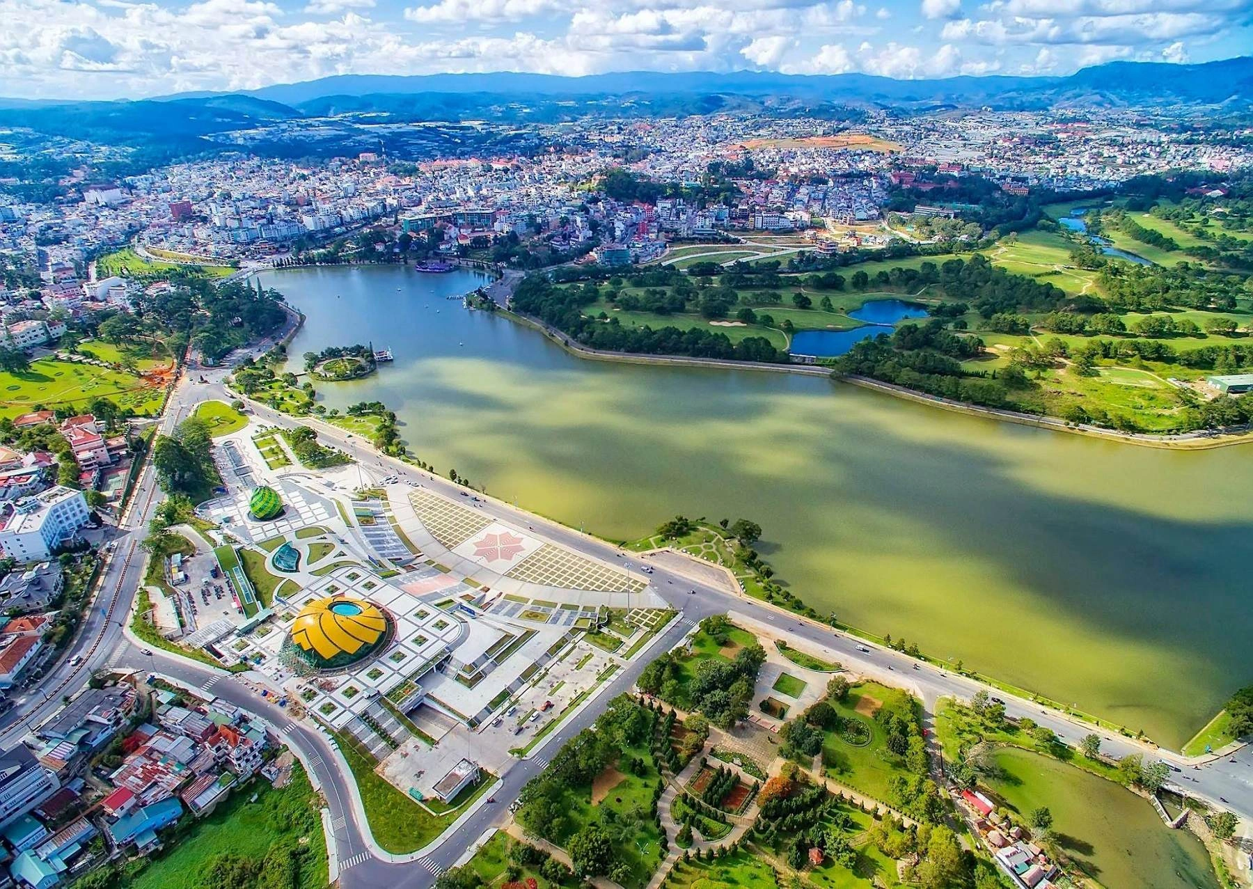
The crescent moon comparison is genuine. Sources vary on the exact size, anywhere from 25 to 32 hectares, and the full walking loop runs a reported five to six kilometers — plan for the longer end of that range, especially if you’re timing the walk around sunset.
That gap between 5 km and 6 km matters more than it sounds ⏱️. It’s the difference between finishing with golden light still on the water and finishing the last stretch by phone flashlight. Give yourself the extra twenty minutes.
A Morning Around the Lake: Sarah’s Step-by-Step Walk
To see how this timing plays out in reality, let’s look at a recent itinerary we planned for Sarah, a traveler who wanted to experience the lake without rushing. Instead of a quick 10-minute photo stop, she dedicated a morning to the full loop.
- Step 1: Sunrise Start (6:00 AM) 🌅: Sarah started near the Lam Vien Square as the mist was still thick. Walking at a relaxed pace, she covered the first 2 kilometers taking photos of the still water before the city traffic woke up.
- Step 2: The Floral Detour (7:15 AM) 🌸: At roughly the halfway point, she stepped off the main path to explore the adjacent flower gardens for 45 minutes, letting her legs rest while enjoying the highland blooms.
- Step 3: Swan Boats and Coffee (8:30 AM) 🦢: Finishing the final stretch near the city center, the pedal-boat operators were just opening. She rented a boat for 30 minutes, capping off the 6km morning with a coffee by the water.
This step-by-step approach turns a simple walking path into a rich, half-day experience.
Ready to Explore Vietnam?
Discover our carefully crafted Vietnam holiday packages for a seamless highland adventure tailored just for you.
Are the Swan Boats Still Running
Yes — but only since August 2025, and only after a suspension that ran nearly a year 🦢.
If a blog post you read last spring told you the swan-shaped pedal boats on Xuan Huong Lake Dalat were gone, that information is now out of date. Da Lat’s city administration requested a halt to the pedal-boat concessions in late 2024 over a licensing gap: the boats had been operating for over three decades without the updated water-resource permits now required under national regulation (Source: Lao Dong News).
Local authorities cleared the boats to resume on August 20, 2025, timed deliberately to the National Day holiday rush, after what local press described as “nearly a year” of suspension (Source: Thanh Nien News). They’ve been running since under the newer licensing framework.

The swan-shaped pedal boats were actually suspended between November 2024 and August 2025 over a licensing dispute. They’re confirmed running again as of the 2026 season.
I’d still build in a five-minute buffer to double-check locally before you commit an evening to it — permitted operating hours shift with the season — but the swan boats themselves are back on the water.
What the 2026 Dredging News Actually Means
No, Xuan Huong Lake itself has not been drained or dug up 🚜. The 2026 dredging headlines are about a different, much smaller body of water next door.
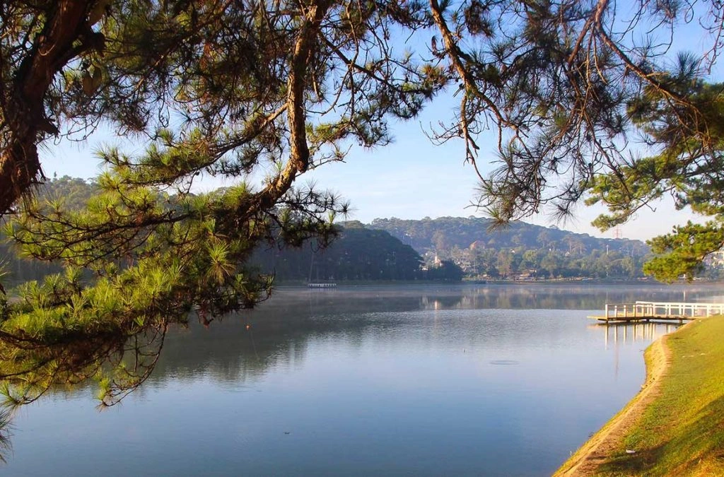
If you’ve seen recent Vietnamese news coverage about excavation work near the lake and worried it meant the main basin was being emptied for repairs, you can relax. In 2026, Lam Dong province approved roughly 48 billion Vietnamese dong for dredging and rebuilding the embankments of “Hồ lắng số 2” — Settling Pond No. 2 — a small silt-catching basin near the intersection of Tran Quoc Toan, Nguyen Tu Luc, and Trang Trinh streets (Source: Dan Tri News).
Don’t assume 2026 dredging headlines mean the lake itself was drained. The project specifically targets an upstream settling pond, a distinction most short news summaries skip entirely.
A dedicated settling pond intercepting silt and street runoff before it reaches the main lake is precisely the kind of unglamorous infrastructure that keeps a 90-year-old reservoir clear enough for the swan boats and the reflections.
Where to Extend the Walk: Pairing the Lake With Da Lat Flower Park

Treat the lake as the spine of your morning, not the whole itinerary. The Da Lat Flower Park sits directly along the same lakeside route, close enough to the promenade that folding it into your loop costs you almost no extra walking.
Where the lake gives you water and mist, the flower park gives you the payoff: terraced beds of hydrangea, dahlia, and local blooms 🌺. Most people treat Xuan Huong Lake as a standalone stop, snap a few photos, and move on toward the market. I’d argue that separating them is a frequent oversight that wastes the momentum you’ve already built.
Frequently Asked Questions
How was Xuan Huong Lake formed?
Quick Answer: It was created by a series of dams across the Cam Ly stream.
The first dam went up between 1919 and 1923. A storm destroyed it and a second dam in March 1932, and the lake was rebuilt in its current form between 1934 and 1935.
How long is the walk around Xuan Huong Lake?
Quick Answer: Trail data typically cites close to 5 kilometers for the paved perimeter loop.
Following the full promenade around every inlet pushes that closer to 6 kilometers — budget for the longer end.
Are the swan boats at Xuan Huong Lake still running?
Quick Answer: Yes.
They were suspended between November 2024 and August 2025 over a licensing gap but resumed on August 20, 2025, and have continued operating into the 2026 season.
Is Xuan Huong Lake being dredged in 2026?
Quick Answer: Not the main lake.
The 2026 project targets a nearby settling pond (“Hồ lắng số 2”) that filters silt before it reaches the lake.
Why is Ho Xuan Huong called the crescent moon lake?
Quick Answer: Its shape genuinely curves like a thin crescent around the base of Dalat’s city center.
This is a comparison that shows up consistently across historical and travel sources.
What’s an ideal time of day to walk around Xuan Huong Lake Dalat?
Quick Answer: Early morning gives you mist over the water and light foot traffic.
Early evening gives you the swan boats lit against the water and market lights along the promenade.
Conclusion
Read this before your evening walk. Xuan Huong Lake rewards you more once you know what you’re actually looking at: a stubborn piece of hydraulic engineering that Dalat rebuilt twice after a storm erased it 🌧️, and keeps quietly maintaining today through settling ponds and licensing paperwork you’ll never see from the promenade. Budget the fuller five-to-six-kilometer loop, fold in the Da Lat Flower Park while you’re already moving, and you’ll get a highly rewarding experience out of your walk around Ho Xuan Huong.
Need Personalized Travel Advice?
We are here to help you plan the perfect trip in Vietnam.
Further Reading & Resources
- “Xuân Hương Lake,” Wikipedia — historical dam construction, 1932 storm, 1934–1935 reconstruction, 1953 renaming. Direct Link
- “Paul Doumer,” Encyclopaedia Britannica — confirms Doumer’s term as Governor-General of French Indochina ran 1897–1902. Direct Link
- “Lý do Đà Lạt tạm ngừng dịch vụ đạp vịt trên hồ Xuân Hương,” Lao Động News — details the late-2024 pedal-boat suspension. Direct Link
- “Đạp vịt trên hồ Xuân Hương hoạt động trở lại sau gần 1 năm tạm dừng,” Thanh Niên News — confirms the pedal-boat service resumption date. Direct Link
- “Lâm Đồng chi 48 tỷ đồng nạo vét hồ lắng bảo vệ hồ Xuân Hương,” Dân Trí News — details the 2026 settling-pond dredging project. Direct Link
- “Xuân Hương Lake Circuit,” AllTrails — walking loop distance and estimated time data. Direct Link

Vani is the Founder and Lead Travel Designer at Truly Voyage. With over a decade of experience and a deep passion for her Vietnamese heritage, she specializes in crafting bespoke, unhurried itineraries. Vani is dedicated to helping travellers experience the authentic soul of Southeast Asia with absolute financial security and 24/7 on-ground support.
0 Comment